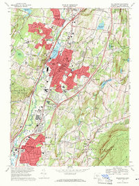
1967 Map of Wallingford
USGS Topo · Published 1971About this map
The Quinnipiac River valley serves as the central corridor for this late-1960s survey of the Wallingford area, where industrial and institutional development clusters along the Penn Central rail line. The map captures a high density of educational and medical landmarks, including the historic Choate Sch campus and the sprawling Masonic Home and Hospital grounds. In the northern reaches, Yalesville sits near the Broad Brook Reservoir, while the southern portion transition into North Haven and Clintonville. Local history is visible in the distribution of family and community landmarks, from the Gaylord Farms Sanatorium to various neighborhood schools such as Whittlesey Ave Sch and Lyman Hall High Sch. Significant water bodies like Community Lake and North Farms Reservoir punctuate the landscape, highlighting the region's managed water resources during this period of suburban expansion.
Find a feature on this map
98 named features on this map. Tap any name to fly to it.
Don’t see what you’re looking for? This feature index may not catch every label — zoom into the map to look around manually.
Map Details
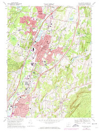
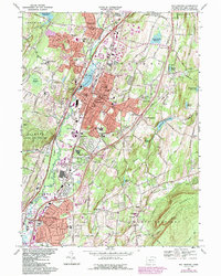
Editions of this 1967 Wallingford Map
3 editions found
Other maps of this area

1892 · New Haven
USGS Topo · 1:62,500

1892 · Meriden
USGS Topo · 1:62,500

1893 · Guilford
USGS Topo · 1:62,500

1893 · Middletown
USGS Topo · 1:62,500

1893 · Meriden
USGS Topo · 1:62,500

1906 · Farmington
USGS Topo · 1:125,000

1921 · New Haven
USGS Topo · 1:62,500

1928 · Cromwell
USGS Topo · 1:24,000

1943 · Durham
USGS Topo · 1:25,000

1943 · New Haven
USGS Topo · 1:31,680