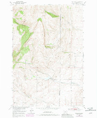
1951 Map of Wallrock
USGS Topo · Published 1981About this map
Wallrock Ridge and the surrounding Wallrock Basin define this landscape along the boundary of Gallatin and Park Counties. This topographic record, compiled as part of a Bureau of Reclamation program for the Missouri River Basin development, details a high-elevation environment dominated by the Gallatin National Forest. The drainage patterns are clearly visible, from the northern flow of Cottonwood Creek to the convergence of the North, Middle, and South Forks.
Find a feature on this map
13 named features on this map. Tap any name to fly to it.
Don’t see what you’re looking for? This feature index may not catch every label — zoom into the map to look around manually.
Map Details
Editions of this 1951 Wallrock Map
3 editions found
Other maps of this area

1886 · Little Belt Mts.
USGS Topo · 1:250,000

1891 · Livingston
USGS Topo · 1:250,000

1893 · Livingston
USGS Topo · 1:250,000

1894 · Little Belt Mts.
USGS Topo · 1:250,000

1897 · Little Belt Mts.
USGS Topo · 1:250,000

1898 · Little Belt Mts.
USGS Topo · 1:250,000

1902 · Little Belt Mts.
USGS Topo · 1:250,000

1947 · Bozeman
USGS Topo · 1:250,000

1948 · Bozeman
USGS Topo · 1:250,000

1948 · White Sulphur Springs
USGS Topo · 1:250,000