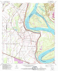
1963 Map of Walls
USGS Topo · Published 1994About this map
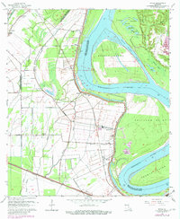
The Mississippi River dominates this landscape, its massive channel flanked by a system of substantial Levees that protect the low-lying parishes of West Baton Rouge and Pointe Coupee. The river's historical shifts are evident in features like Profit Island and the narrow Profit Island Chute, along with numerous oxbow remnants such as Stumpy Lake and Horseshoe Lake. Settlement patterns follow the higher ground near the river and railroads, with small communities like Smithfield, Chamberlin, and Arbroth linked by the Texas and Pacific rail line.
Find a feature on this map
49 named features on this map. Tap any name to fly to it.
Don’t see what you’re looking for? This feature index may not catch every label — zoom into the map to look around manually.
Map Details
Editions of this 1963 Walls Map
5 editions found
Other maps of this area

1906 · Bayou Sara
USGS Topo · 1:125,000

1908 · Baton Rouge
USGS Topo · 1:62,500

1939 · Zachary
USGS Topo · 1:62,500

1939 · Baton Rouge
USGS Topo · 1:62,500

1940 · Grosse Tete
USGS Topo · 1:62,500

1953 · Baton Rouge West
USGS Topo · 1:24,000

1953 · Lobdell
USGS Topo · 1:24,000

1953 · New Roads
USGS Topo · 1:24,000

1954 · Zachary
USGS Topo · 1:24,000

1954 · Port Hudson
USGS Topo · 1:24,000