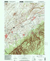
1999 Map of Walnut Bottom
USGS Topo · Published 2001About this map
Yellow Breeches Creek flows through the northern reaches of this Cumberland County landscape, where the agricultural plains of South Newton meet the rising slopes of South Mountain. The map shows a well-established network of rural educational centers, including the Newton Township Consolidated School and Fairview School, reflecting the community's commitment to local schooling throughout the mid-to-late 20th century.
Find a feature on this map
38 named features on this map. Tap any name to fly to it.
Don’t see what you’re looking for? This feature index may not catch every label — zoom into the map to look around manually.
Map Details
Editions of this 1999 Walnut Bottom Map
This is the sole edition of this map. No revisions or reprints were ever made.
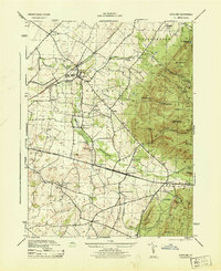
Other maps of this area

1902 · Chambersburg
USGS Topo · 1:62,500

1909 · Fairfield
USGS Topo · 1:62,500

1919 · Newville
USGS Topo · 1:62,500

1923 · Shippensburg
USGS Topo · 1:62,500

1942 · Hagerstown
USGS Topo · 1:125,000

1942 · Gettysburg
USGS Topo · 1:125,000

1943 · Hagerstown
USGS Topo · 1:125,000

1943 · Chambersburg
USGS Topo · 1:62,500

1943 · Shippensburg
USGS Topo · 1:62,500
1944 · Scotland
USGS Topo · 1:31,680