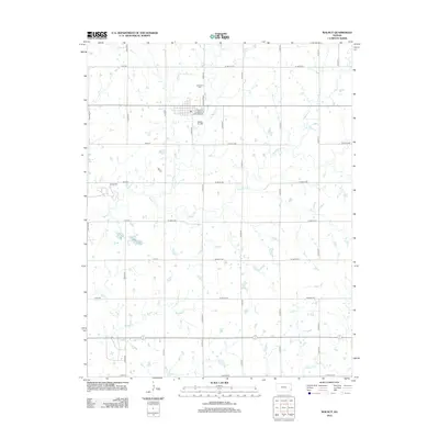
2012 Map of Walnut
USGS Topo · Published 2012About this map
Walnut, Kansas, occupies a structured grid of residential streets and rural corridors in Crawford County, defined by the winding course of Walnut Cr and its many tributaries. The town’s layout is anchored by N Magnolia St and S Main St, with a cluster of local thoroughfares including E Miller St and E Gettings St forming the community core. Beyond the immediate settlement, the landscape transitions into a vast network of section roads like Xavier Rd and W 650th Ave. Local heritage is preserved at Glenwood Cem north of town and Fowler Cem to the southwest near the banks of Walnut Cr. The drainage pattern is particularly intricate here, with Little Walnut Cr, Pony Cr, and Brogan Cr carving through the agricultural plains, illustrating the water-dependent settlement patterns of eastern Kansas.
Find a feature on this map
40 named features on this map. Tap any name to fly to it.
Don’t see what you’re looking for? This feature index may not catch every label — zoom into the map to look around manually.
Map Details
Editions of this 2012 Walnut Map
This is the sole edition of this map. No revisions or reprints were ever made.
Other maps of this area

1884 · Fort Scott
USGS Topo · 1:125,000

1886 · Joplin
USGS Topo · 1:125,000

1886 · Iola
USGS Topo · 1:125,000

1886 · Fort Scott
USGS Topo · 1:125,000

1886 · Parsons
USGS Topo · 1:125,000

1893 · Fort Scott
USGS Topo · 1:125,000

1893 · Iola
USGS Topo · 1:125,000

1893 · Parsons
USGS Topo · 1:125,000

1894 · Joplin
USGS Topo · 1:125,000

1904 · Iola
USGS Topo · 1:125,000