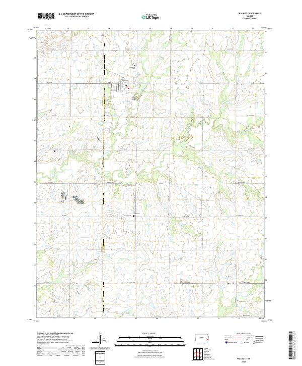
2022 Map of Walnut
USGS Topo · Published 2022About this map
Walnut occupies the northern section of this Kansas landscape, situated near the boundary where Neosho Co and Crawford Co meet. The town's grid is centered near the confluence of Pony Cr and Little Walnut Cr, which join to form the larger Walnut Cr as it winds southward. This area is defined by a dense network of sectional roads, including W Miller St and E Front St, which connect the town to the surrounding agricultural prairie. Local history and genealogy are preserved in several rural burial grounds such as Glenwood Cem, located just north of the town site, and the Fowler Cem further west. In the southern portion of the quadrangle, the terrain is drained by Brogan Cr, Murphy Cr, and Hickory Cr, illustrating the typical drainage patterns of the Cherokee Plain.
Find a feature on this map
35 named features on this map. Tap any name to fly to it.
Don’t see what you’re looking for? This feature index may not catch every label — zoom into the map to look around manually.
Map Details
Editions of this 2022 Walnut Map
This is the sole edition of this map. No revisions or reprints were ever made.
Other maps of this area

1884 · Fort Scott
USGS Topo · 1:125,000

1886 · Joplin
USGS Topo · 1:125,000

1886 · Iola
USGS Topo · 1:125,000

1886 · Fort Scott
USGS Topo · 1:125,000

1886 · Parsons
USGS Topo · 1:125,000

1893 · Fort Scott
USGS Topo · 1:125,000

1893 · Iola
USGS Topo · 1:125,000

1893 · Parsons
USGS Topo · 1:125,000

1894 · Joplin
USGS Topo · 1:125,000

1904 · Iola
USGS Topo · 1:125,000