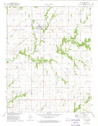
1973 Map of Walnut
USGS Topo · Published 1975About this map
The town of Walnut sits at a historic junction of the Atchison Topeka and Santa Fe and the Missouri - Kansas - Texas railroads, serving as a hub for the surrounding prairies of Crawford and Neosho counties. A significant historical line, the Indian Treaty Boundary, cuts across the center of the map, marking a legacy of land division in the region. The landscape is defined by the winding paths of Walnut Creek and Little Walnut Creek, where the natural drainage of Walnut Grove meets an active extractive economy. Numerous oil wells, gas wells, and a designated Oil Field are scattered across the terrain, indicating the importance of energy production in the early 1970s. For those tracing local history, the map preserves the locations of the Walnut Grange Hall, Glenwood Cem, and Fowler Cem, alongside the conserved wetlands of the Neosho State Waterfowl Management Area.
Find a feature on this map
27 named features on this map. Tap any name to fly to it.
Don’t see what you’re looking for? This feature index may not catch every label — zoom into the map to look around manually.
Map Details
Editions of this 1973 Walnut Map
This is the sole edition of this map. No revisions or reprints were ever made.
Other maps of this area

1884 · Fort Scott
USGS Topo · 1:125,000

1886 · Joplin
USGS Topo · 1:125,000

1886 · Iola
USGS Topo · 1:125,000

1886 · Fort Scott
USGS Topo · 1:125,000

1886 · Parsons
USGS Topo · 1:125,000

1893 · Fort Scott
USGS Topo · 1:125,000

1893 · Iola
USGS Topo · 1:125,000

1893 · Parsons
USGS Topo · 1:125,000

1894 · Joplin
USGS Topo · 1:125,000

1904 · Iola
USGS Topo · 1:125,000