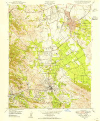
1947 Map of Walnut Creek
USGS Topo · Published 1954About this map
Concord and Walnut Creek appear as emerging hubs in this late-1940s landscape, where orchards and open valleys are beginning to meet postwar suburban development. The transportation network is anchored by the Sacramento Northern and Southern Pacific railroads, alongside the heavy industrial corridor of the Arnold Industrial Highway. Local history is visible in the distribution of family-named landmarks and institutions, such as the Fernando Adobe and the Japanese Institute (Aban'd), reflecting the area's diverse heritage before mid-century expansion. Significant water infrastructure like the Contra Costa Canal and Mokelumne Aqueduct cuts through the terrain, supporting the transition from agricultural tracts near Pacheco to the growing residential footprints of Saranap and Lafayette. The presence of Buchanan Field and the Naval Reservation highlights the strategic and logistical importance of this Contra Costa region during the era.
Find a feature on this map
68 named features on this map. Tap any name to fly to it.
Don’t see what you’re looking for? This feature index may not catch every label — zoom into the map to look around manually.
Map Details
Editions of this 1947 Walnut Creek Map
This is the sole edition of this map. No revisions or reprints were ever made.
Other maps of this area

1896 · Carquinez Strait
USGS Topo · 1:62,500

1896 · Mt. Diablo
USGS Topo · 1:62,500

1897 · Concord
USGS Topo · 1:62,500

1898 · Karquines
USGS Topo · 1:62,500

1898 · Mt. Diablo
USGS Topo · 1:62,500

1901 · Karquines
USGS Topo · 1:62,500

1902 · Napa
USGS Topo · 1:125,000

1907 · Antioch
USGS Topo · 1:62,500

1908 · Antioch
USGS Topo · 1:62,500

1915 · Concord
USGS Topo · 1:62,500