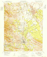
1949 Map of Walnut Creek
USGS Topo · Published 1949About this map
The Ygnacio Valley and surrounding foothills of Contra Costa County appear here during a period of significant post-war transition. Centered on the growing hubs of Concord and Walnut Creek, the map illustrates a landscape where agricultural roots meet new suburban and industrial developments. Key transportation corridors like the Sacramento Northern and Southern Pacific railroads are depicted alongside the Contra Costa Canal, which was vital for regional water management. Educational and social foundations are well-documented, from the Acalanes Union H S and Pleasant Hill School to the Japanese Institute (Aban'd). Aviation and military presence are noted through Buchanan Field and the adjacent Naval Reservation, while local community life is reflected in landmarks like the Contra Costa Golf Club and the IOOF Cemetery.
Find a feature on this map
54 named features on this map. Tap any name to fly to it.
Don’t see what you’re looking for? This feature index may not catch every label — zoom into the map to look around manually.
Map Details
Editions of this 1949 Walnut Creek Map
2 editions found
Other maps of this area

1896 · Carquinez Strait
USGS Topo · 1:62,500

1896 · Mt. Diablo
USGS Topo · 1:62,500

1897 · Concord
USGS Topo · 1:62,500

1898 · Karquines
USGS Topo · 1:62,500

1898 · Mt. Diablo
USGS Topo · 1:62,500

1901 · Karquines
USGS Topo · 1:62,500

1902 · Napa
USGS Topo · 1:125,000

1907 · Antioch
USGS Topo · 1:62,500

1908 · Antioch
USGS Topo · 1:62,500

1915 · Concord
USGS Topo · 1:62,500