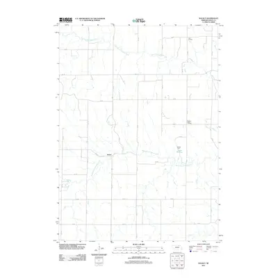
2011 Map of Walnut
USGS Topo · Published 2011About this map
Walnut serves as the central point in this rural landscape of northern Nebraska, where the section-line road grid organizes a territory defined by the winding paths of the Verdigre Creek system. The hydrology of the region is anchored by the North Branch Verdigre Creek and the Middle Branch Verdigre Creek, which cut through the agricultural fields and pastures. Significant local landmarks include the Sukup Reservoir and Sukup Dam, providing a localized water management point amidst the rolling topography. The map also documents important sites for genealogical research, such as Jelen Cemetery in the northeast corner and Pleasant Valley Cemetery further south, preserving the names of early settler families and communities. The reliance on a systematic grid of avenues and roads, from 514 Ave to 875 Rd, illustrates the enduring structure of the Great Plains' rural infrastructure.
Find a feature on this map
23 named features on this map. Tap any name to fly to it.
Don’t see what you’re looking for? This feature index may not catch every label — zoom into the map to look around manually.
Map Details
Editions of this 2011 Walnut Map
This is the sole edition of this map. No revisions or reprints were ever made.
Other maps of this area

1950 · Verdigre NE
USGS Topo · 1:24,000

1950 · Pishelville
USGS Topo · 1:24,000

1952 · Dorsey
USGS Topo · 1:24,000

1954 · Walnut
USGS Topo · 1:24,000

1954 · Verdigre
USGS Topo · 1:24,000

1954 · Star
USGS Topo · 1:24,000

1955 · O'Neill
USGS Topo · 1:250,000

1959 · O'Neill
USGS Topo · 1:250,000

1963 · Orchard NE
USGS Topo · 1:24,000

1963 · Venus
USGS Topo · 1:24,000