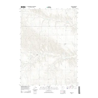
2014 Map of Walnut
USGS Topo · Published 2014About this map
Walnut sits within a landscape defined by the drainage systems of the Verdigre Creek in rural Knox County. This 2014 survey illustrates the intricate network of section roads that provide access across the undulating terrain, including 881 Rd and 518 Ave. The agricultural and community character of the region is anchored by local landmarks such as Pleasant Valley Cem and Jelen Cem, which serve as vital points for genealogical research. Water management is evident through the presence of the Sukup Reservoir, while the natural winding paths of the Middle Br Verdigre Cr and N Br Verdigre Cr dictate the local topography. The map reflects a modern period of rural Nebraska, where traditional land divisions remain the primary structure for settlement and transportation.
Find a feature on this map
18 named features on this map. Tap any name to fly to it.
Don’t see what you’re looking for? This feature index may not catch every label — zoom into the map to look around manually.
Map Details
Editions of this 2014 Walnut Map
This is the sole edition of this map. No revisions or reprints were ever made.
Other maps of this area

1950 · Verdigre NE
USGS Topo · 1:24,000

1950 · Pishelville
USGS Topo · 1:24,000

1952 · Dorsey
USGS Topo · 1:24,000

1954 · Walnut
USGS Topo · 1:24,000

1954 · Verdigre
USGS Topo · 1:24,000

1954 · Star
USGS Topo · 1:24,000

1955 · O'Neill
USGS Topo · 1:250,000

1959 · O'Neill
USGS Topo · 1:250,000

1963 · Orchard NE
USGS Topo · 1:24,000

1963 · Venus
USGS Topo · 1:24,000