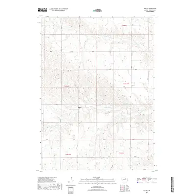
2017 Map of Walnut
USGS Topo · Published 2017About this map
Walnut lies at the heart of this Knox County landscape, where the drainage of the Verdigre Creek system carves a complex network of ridges and draws across the Nebraska prairie. The northern portion of the quadrangle is defined by the winding course of the N Br Verdigre Cr, while the Middle Br Verdigre Cr and the Sukup Reservoir anchor the central topography. This 2017 survey reveals a rural infrastructure built on a precise grid of section lines and gravel roads, such as 876 Rd and CO Oil Rd. For those tracing local heritage, the map identifies small, significant community sites including Jelen Cem in the north and Pleasant Valley Cem further south, both situated near high points overlooking the creek valleys. The arrangement of these cemeteries and the surviving settlement at Walnut illustrate the enduring patterns of early 20th-century upland ranching and farming communities.
Find a feature on this map
21 named features on this map. Tap any name to fly to it.
Don’t see what you’re looking for? This feature index may not catch every label — zoom into the map to look around manually.
Map Details
Editions of this 2017 Walnut Map
This is the sole edition of this map. No revisions or reprints were ever made.
Other maps of this area

1950 · Verdigre NE
USGS Topo · 1:24,000

1950 · Pishelville
USGS Topo · 1:24,000

1952 · Dorsey
USGS Topo · 1:24,000

1954 · Walnut
USGS Topo · 1:24,000

1954 · Verdigre
USGS Topo · 1:24,000

1954 · Star
USGS Topo · 1:24,000

1955 · O'Neill
USGS Topo · 1:250,000

1959 · O'Neill
USGS Topo · 1:250,000

1963 · Orchard NE
USGS Topo · 1:24,000

1963 · Venus
USGS Topo · 1:24,000