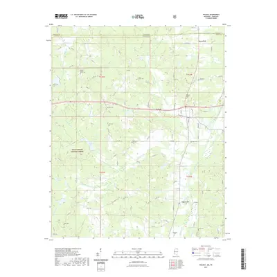
2021 Map of Walnut
USGS Topo · Published 2021About this map
Walnut and Tiplersville anchor this northern Tippah County landscape, where the rolling hills of the Holly Springs National Forest meet the Tennessee state line. The terrain is deeply carved by a network of waterways including Muddy Creek, Hurricane Cr, and Spicewood Cr, which feed into larger bodies like Muddy Lake and Oak Grove Lake. This area is characterized by its dispersed rural settlements and a high density of country burial grounds that tell the story of early families in the region. Notable sites such as the Oakland Baptist Church Cem and Harmony Baptist Cem serve as focal points for local history. Further south, the community of Tiplersville is marked by the Tiplersville Cem, while the northern reaches include the small settlement of Brownfield near the border, illustrating a legacy of small-town commerce and community centered around the local road system.
Find a feature on this map
109 named features on this map. Tap any name to fly to it.
Don’t see what you’re looking for? This feature index may not catch every label — zoom into the map to look around manually.
Map Details
Editions of this 2021 Walnut Map
This is the sole edition of this map. No revisions or reprints were ever made.
Other maps of this area

1950 · Ashland
USGS Topo · 1:62,500

1950 · Pocahontas
USGS Topo · 1:24,000

1950 · Middleton
USGS Topo · 1:24,000

1951 · Middleton
USGS Topo · 1:24,000

1951 · Walnut
USGS Topo · 1:62,500

1952 · Pocahontas
USGS Topo · 1:24,000

1952 · Saulsbury
USGS Topo · 1:24,000

1956 · Blytheville
USGS Topo · 1:250,000

1956 · Tupelo
USGS Topo · 1:250,000

1958 · Tupelo
USGS Topo · 1:250,000