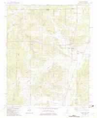
1982 Map of Walnut
USGS Topo · Published 1983About this map
Walnut serves as the primary hub of this northern Mississippi landscape, situated at the intersection of the Gulf Mobile And Ohio and Illinois Central railroads. This 1982 map highlights a region where the western reaches of the Holly Springs National Forest meet an active agricultural and industrial corridor. Numerous Sandpits are scattered throughout the terrain, particularly along the waterways of Muddy Creek and Hurricane Creek, indicating the local extraction economy of the era.
Find a feature on this map
45 named features on this map. Tap any name to fly to it.
Don’t see what you’re looking for? This feature index may not catch every label — zoom into the map to look around manually.
Map Details
Editions of this 1982 Walnut Map
This is the sole edition of this map. No revisions or reprints were ever made.
Other maps of this area

1950 · Ashland
USGS Topo · 1:62,500

1950 · Pocahontas
USGS Topo · 1:24,000

1950 · Middleton
USGS Topo · 1:24,000

1951 · Middleton
USGS Topo · 1:24,000

1951 · Walnut
USGS Topo · 1:62,500

1952 · Pocahontas
USGS Topo · 1:24,000

1952 · Saulsbury
USGS Topo · 1:24,000

1956 · Blytheville
USGS Topo · 1:250,000

1956 · Tupelo
USGS Topo · 1:250,000

1958 · Tupelo
USGS Topo · 1:250,000