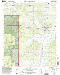
2000 Map of Walnut
USGS Topo · Published 2003About this map
Walnut sits at the heart of this landscape, serving as a hub near the Tennessee Mississippi border. The area is defined by a dense network of country churches and family burial grounds, reflecting the deep-rooted community history of Tippah County. From Oakland Ch in the northwest to Tiplersville in the south, the map documents the religious and social centers that anchored rural life at the end of the twentieth century.
Find a feature on this map
47 named features on this map. Tap any name to fly to it.
Don’t see what you’re looking for? This feature index may not catch every label — zoom into the map to look around manually.
Map Details
Editions of this 2000 Walnut Map
This is the sole edition of this map. No revisions or reprints were ever made.
Other maps of this area

1950 · Ashland
USGS Topo · 1:62,500

1950 · Pocahontas
USGS Topo · 1:24,000

1950 · Middleton
USGS Topo · 1:24,000

1951 · Middleton
USGS Topo · 1:24,000

1951 · Walnut
USGS Topo · 1:62,500

1952 · Pocahontas
USGS Topo · 1:24,000

1952 · Saulsbury
USGS Topo · 1:24,000

1956 · Blytheville
USGS Topo · 1:250,000

1956 · Tupelo
USGS Topo · 1:250,000

1958 · Tupelo
USGS Topo · 1:250,000