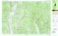
1985 Map of Walpole
USGS Topo · Published 1985About this map
The Connecticut River serves as the primary artery for this mid-1980s landscape, defining the state boundary between Westminster, Vermont, and Walpole, New Hampshire. Along its banks, the Boston and Maine railroad line connects riverside settlements like Westminster Station and Putney with the larger regional economy. The map illustrates a heavily wooded, high-relief terrain characterized by several distinct peaks, including Hitchcock Mtn, Rice Mtn, and Gibbs Mountain.
Find a feature on this map
70 named features on this map. Tap any name to fly to it.
Don’t see what you’re looking for? This feature index may not catch every label — zoom into the map to look around manually.
Map Details
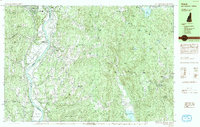
Editions of this 1985 Walpole Map
2 editions found
Other maps of this area

1891 · Brattleboro
USGS Topo · 1:62,500

1893 · Brattleboro
USGS Topo · 1:62,500

1898 · Monadnock
USGS Topo · 1:62,500

1898 · Keene
USGS Topo · 1:62,500

1927 · Bellows Falls
USGS Topo · 1:48,000

1930 · Saxtons River
USGS Topo · 1:48,000

1930 · Lovewell Mountain
USGS Topo · 1:62,500

1930 · Bellows Falls
USGS Topo · 1:62,500

1932 · Brattleboro
USGS Topo · 1:48,000

1932 · Keene
USGS Topo · 1:62,500