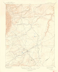
1897 Map of Walsenburg
USGS Topo · Published 1949About this map
The intersection of mountain topography and rail-driven settlement defines this 1894 survey of Huerfano County. Walsenburg serves as the central hub, where the Denver and Rio Grande R. R. splits into the La Veta Branch and the Trinidad Line. This rail network was essential for connecting the coal mining outposts and agricultural communities of the high plains to larger markets. Notable settlements like Pictou, Rouse, and Tioga underscore the industrial character of the era, while the Colorado and Southern R. R. skirts the southern portion of the sheet.
Find a feature on this map
40 named features on this map. Tap any name to fly to it.
Don’t see what you’re looking for? This feature index may not catch every label — zoom into the map to look around manually.
Map Details
Editions of this 1897 Walsenburg Map
4 editions found

Other maps of this area

1889 · Canon City
USGS Topo · 1:125,000

1889 · Huerfano Park
USGS Topo · 1:125,000

1891 · Walsenburg
USGS Topo · 1:125,000

1891 · Pueblo
USGS Topo · 1:125,000

1891 · Spanish Peaks
USGS Topo · 1:125,000

1891 · Nepesta
USGS Topo · 1:125,000

1891 · Apishapa
USGS Topo · 1:125,000

1892 · Huerfano Park
USGS Topo · 1:125,000

1892 · Canon City
USGS Topo · 1:125,000

1892 · Elmoro
USGS Topo · 1:125,000