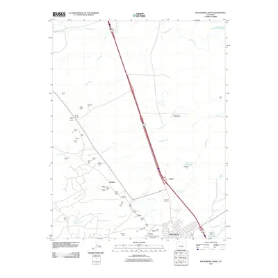
2010 Map of Walsenburg North
USGS Topo · Published 2010About this map
The northern reaches of Walsenburg and the surrounding high plains of Huerfano County reveal an intensive history of resource extraction. A high density of coal operations, including the Huerfano Coal Mine, Strong Mine, and Tioga Mine, defines the industrial footprint of this landscape. Many of these sites, such as the Morning Glory Mine and Black Canyon Mine, are clustered around the small settlements of Pictou and Maitland.
Find a feature on this map
53 named features on this map. Tap any name to fly to it.
Don’t see what you’re looking for? This feature index may not catch every label — zoom into the map to look around manually.
Map Details
Editions of this 2010 Walsenburg North Map
This is the sole edition of this map. No revisions or reprints were ever made.
Other maps of this area

1891 · Walsenburg
USGS Topo · 1:125,000

1894 · Walsenburg
USGS Topo · 1:125,000

1897 · Walsenburg
USGS Topo · 1:125,000

1900 · Walsenburg
USGS Topo · 1:125,000

1954 · Trinidad
USGS Topo · 1:250,000

1955 · Trinidad
USGS Topo · 1:250,000

1958 · Trinidad
USGS Topo · 1:250,000

1959 · Trinidad
USGS Topo · 1:250,000
1963 · Ritter Arroyo
USGS Topo · 1:24,000
1963 · Walsenburg South
USGS Topo · 1:24,000