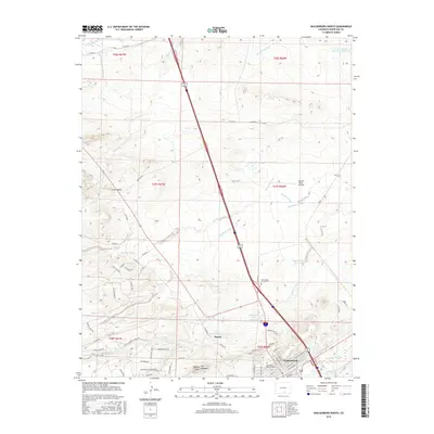
2016 Map of Walsenburg North
USGS Topo · Published 2016About this map
Walsenburg and the adjacent settlement of Pictou anchor this landscape where the high plains meet the prominent geological rise of The Hogback. The terrain is defined by complex water management, featuring a network of irrigation and storage systems including the Homestead Canal, Lake Merriam Ditch, and Gomez Ditch. These waterways support several significant impoundments such as the Huajatolla Hills Reservoir and Ladoya Reservoir. North of the town center, Spanish Peaks Airfield occupies the flat reaches between Maitland Arroyo and Gordon Arroyo. Genealogists will find local history preserved at Saint Marys North Cem and the Huerfano Masonic Cem. The map illustrates a distinctive transition from the riparian corridors of the Huerfano River in the north to the Cucharas River in the south, punctuated by rocky landmarks like Walsen Crag and Long Saddle.
Find a feature on this map
77 named features on this map. Tap any name to fly to it.
Don’t see what you’re looking for? This feature index may not catch every label — zoom into the map to look around manually.
Map Details
Editions of this 2016 Walsenburg North Map
This is the sole edition of this map. No revisions or reprints were ever made.
Other maps of this area

1891 · Walsenburg
USGS Topo · 1:125,000

1894 · Walsenburg
USGS Topo · 1:125,000

1897 · Walsenburg
USGS Topo · 1:125,000

1900 · Walsenburg
USGS Topo · 1:125,000

1954 · Trinidad
USGS Topo · 1:250,000

1955 · Trinidad
USGS Topo · 1:250,000

1958 · Trinidad
USGS Topo · 1:250,000

1959 · Trinidad
USGS Topo · 1:250,000
1963 · Ritter Arroyo
USGS Topo · 1:24,000
1963 · Walsenburg South
USGS Topo · 1:24,000