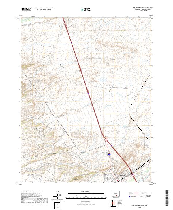
2022 Map of Walsenburg North
USGS Topo · Published 2022About this map
The northern edge of Walsenburg and the neighboring settlement of Pictou anchor this 2022 survey of Huerfano County. The landscape is defined by the striking geological rise of The Hogback and Walsen Crag, which dominate the southern terrain. This area demonstrates a complex water management system essential for the high plains, featuring the Cucharas River, the Huerfano River to the north, and various man-made developments like the Lake Merriam Ditch and Holita Ditch. Local history and genealogy are represented by the Saint Marys North Cem and Huerfano Masonic Cem, while transportation and aviation needs are met by the Spanish Peaks Airfield. The map reveals a mix of older rural routes like Co RD 640 and modern residential developments branching off Huajatolla Blvd and Culebra Blvd near the town center, reflecting the continued growth of this Southern Colorado community.
Find a feature on this map
76 named features on this map. Tap any name to fly to it.
Don’t see what you’re looking for? This feature index may not catch every label — zoom into the map to look around manually.
Map Details
Editions of this 2022 Walsenburg North Map
This is the sole edition of this map. No revisions or reprints were ever made.
Other maps of this area

1891 · Walsenburg
USGS Topo · 1:125,000

1894 · Walsenburg
USGS Topo · 1:125,000

1897 · Walsenburg
USGS Topo · 1:125,000

1900 · Walsenburg
USGS Topo · 1:125,000

1954 · Trinidad
USGS Topo · 1:250,000

1955 · Trinidad
USGS Topo · 1:250,000

1958 · Trinidad
USGS Topo · 1:250,000

1959 · Trinidad
USGS Topo · 1:250,000
1963 · Ritter Arroyo
USGS Topo · 1:24,000
1963 · Walsenburg South
USGS Topo · 1:24,000