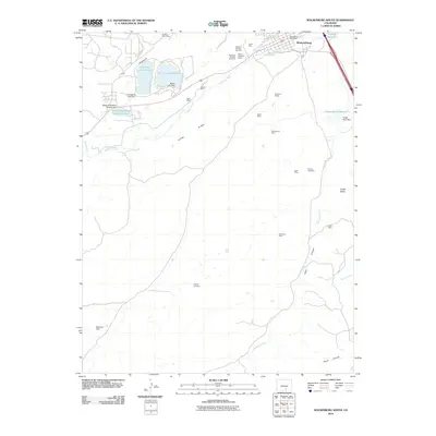
2010 Map of Walsenburg South
USGS Topo · Published 2010About this map
Walsenburg anchors the northern edge of this landscape, where the Huerfano River and Cucharas River meet a terrain defined by coal heritage and water management. The southern outskirts of the town are marked by an extensive legacy of resource extraction, with numerous workings such as the Walsen Robinson Mines, Mutual Mine, and Cameron Mines scattered across the plains. These sites, along with others like the Ravenwood Mine and Peak Mine, trace the industrial footprint of the region's mining era.
Find a feature on this map
38 named features on this map. Tap any name to fly to it.
Don’t see what you’re looking for? This feature index may not catch every label — zoom into the map to look around manually.
Map Details
Editions of this 2010 Walsenburg South Map
This is the sole edition of this map. No revisions or reprints were ever made.
Other maps of this area

1891 · Walsenburg
USGS Topo · 1:125,000

1891 · Spanish Peaks
USGS Topo · 1:125,000

1893 · Spanish Peaks
USGS Topo · 1:125,000

1894 · Walsenburg
USGS Topo · 1:125,000

1895 · Spanish Peaks
USGS Topo · 1:125,000

1897 · Walsenburg
USGS Topo · 1:125,000

1897 · Spanish Peaks
USGS Topo · 1:125,000

1900 · Spanish Peaks
USGS Topo · 1:125,000

1900 · Walsenburg
USGS Topo · 1:125,000

1954 · Trinidad
USGS Topo · 1:250,000