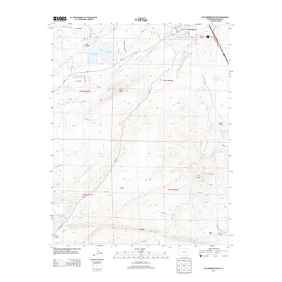
2013 Map of Walsenburg South
USGS Topo · Published 2013About this map
Walsenburg sits at the northern edge of this high-plains landscape, where the town's grid meets the complex geology of Huerfano County. This survey captures a terrain defined by dramatic vertical features and vital water management, most notably The Hogback and the striking Big Dike formation. The presence of the Laguna Cem south of the main settlement offers a point of interest for genealogists, while the cluster of reservoirs, including Horseshoe Lake Reservoir and Martin Lake Reservoir within Lathrop State Park, illustrates the region's reliance on the Cucharas River and an intricate network of irrigation channels like Lake Merriam-Ditch and Gomez Ditch. As the land rises toward the south, the map reveals the transition into more broken country at Ideal Canyon and Pryor Canyon, marked by prominent landmarks like the Castle Rocks and Unfug Ridge.
Find a feature on this map
63 named features on this map. Tap any name to fly to it.
Don’t see what you’re looking for? This feature index may not catch every label — zoom into the map to look around manually.
Map Details
Editions of this 2013 Walsenburg South Map
This is the sole edition of this map. No revisions or reprints were ever made.
Other maps of this area

1891 · Walsenburg
USGS Topo · 1:125,000

1891 · Spanish Peaks
USGS Topo · 1:125,000

1893 · Spanish Peaks
USGS Topo · 1:125,000

1894 · Walsenburg
USGS Topo · 1:125,000

1895 · Spanish Peaks
USGS Topo · 1:125,000

1897 · Walsenburg
USGS Topo · 1:125,000

1897 · Spanish Peaks
USGS Topo · 1:125,000

1900 · Spanish Peaks
USGS Topo · 1:125,000

1900 · Walsenburg
USGS Topo · 1:125,000

1954 · Trinidad
USGS Topo · 1:250,000