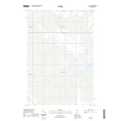
2019 Map of Walsh
USGS Topo · Published 2019About this map
Creighton Marsh dominates this landscape in the Upper Peninsula, defining a region where water and land are inextricably linked. The small settlement of Walsh sits along the northern edge of the wetlands, positioned where M 28 and the historic Walsh Grade corridor traverse the terrain. The map reveals an intricate network of moving water, from the winding Driggs River in the east to the Creighton River in the southwest corner. Local drainage is further marked by the flows of Walsh Cr, Ducey Cr, and Marsh Cr. The presence of Spur Ditch suggests historical efforts to manage the hydrology of this marsh-heavy environment. This map captures the mid-century infrastructure of Schoolcraft County, including Ecklund Rd and Co Hwy 448, which provide access to the remote backcountry between these river systems.
Find a feature on this map
16 named features on this map. Tap any name to fly to it.
Don’t see what you’re looking for? This feature index may not catch every label — zoom into the map to look around manually.
Map Details
Editions of this 2019 Walsh Map
This is the sole edition of this map. No revisions or reprints were ever made.
Other maps of this area

1931 · Manistique River NE
USGS Topo · 1:31,680

1931 · Driggs Lake NE
USGS Topo · 1:31,680

1931 · Steuben NE
USGS Topo · 1:31,680

1931 · Manistique River NW
USGS Topo · 1:31,680

1931 · Shingleton NE
USGS Topo · 1:31,680

1931 · Driggs Lake NW
USGS Topo · 1:31,680

1931 · Shingleton SE
USGS Topo · 1:31,680

1931 · Driggs Lake SW
USGS Topo · 1:31,680

1931 · Driggs Lake SE
USGS Topo · 1:31,680

1958 · Shingleton
USGS Topo · 1:62,500