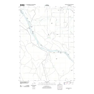
2010 Map of Walters Butte
USGS Topo · Published 2010About this map
Walters Ferry stands as a significant historical crossing point along the Snake River corridor, anchoring a landscape defined by its transition from riverbank to volcanic uplands. This 2010 survey illustrates the sophisticated network of water management essential to the region, featuring the Waldvogel Canal, Walters Butte Lateral, and Nicholson Ditch. The presence of the Guffey Railroad Bridge near Guffey and Guffey Butte highlights the intersection of transportation and topography, where rail infrastructure met the challenge of the river's basalt-lined path.
Find a feature on this map
59 named features on this map. Tap any name to fly to it.
Don’t see what you’re looking for? This feature index may not catch every label — zoom into the map to look around manually.
Map Details
Editions of this 2010 Walters Butte Map
This is the sole edition of this map. No revisions or reprints were ever made.
Other maps of this area

1892 · Bisuka
USGS Topo · 1:125,000

1892 · Silver City
USGS Topo · 1:125,000

1894 · Bisuka
USGS Topo · 1:125,000

1894 · Silver City
USGS Topo · 1:125,000

1898 · Silver City
USGS Topo · 1:125,000

1948 · Sinker Butte
USGS Topo · 1:24,000

1949 · Sinker Butte
USGS Topo · 1:24,000

1949 · Oreana
USGS Topo · 1:62,500

1955 · Boise
USGS Topo · 1:250,000
1957 · Walters Butte
USGS Topo · 1:24,000