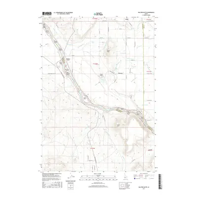
2017 Map of Walters Butte
USGS Topo · Published 2017About this map
Walters Ferry marks a historic crossing point on the Snake River, where the waterway carves through the volcanic landscape of the Canyon and Owyhee County border. This modern 2017 survey reveals an intricate irrigation network essential to the region's agricultural character, featuring the Waldvogel Canal, Walters Butte Lateral, and Whizzer Lateral. The landscape is dominated by high desert buttes and riverine islands, including Walters Butte, White Butte, and Guffey Butte. Notable infrastructure like the Guffey Railroad Bridge and the Halverson Lake Trail highlight the intersection of historical transit and modern recreation. To the north, the settlement of Melba and the smaller enclave of Warrens serve as anchors for the surrounding farm and ranch land, while the Snake River itself is punctuated by numerous named landforms such as Noble Island and Big Rocky Island.
Find a feature on this map
75 named features on this map. Tap any name to fly to it.
Don’t see what you’re looking for? This feature index may not catch every label — zoom into the map to look around manually.
Map Details
Editions of this 2017 Walters Butte Map
This is the sole edition of this map. No revisions or reprints were ever made.
Other maps of this area

1892 · Bisuka
USGS Topo · 1:125,000

1892 · Silver City
USGS Topo · 1:125,000

1894 · Bisuka
USGS Topo · 1:125,000

1894 · Silver City
USGS Topo · 1:125,000

1898 · Silver City
USGS Topo · 1:125,000

1948 · Sinker Butte
USGS Topo · 1:24,000

1949 · Sinker Butte
USGS Topo · 1:24,000

1949 · Oreana
USGS Topo · 1:62,500

1955 · Boise
USGS Topo · 1:250,000
1957 · Walters Butte
USGS Topo · 1:24,000