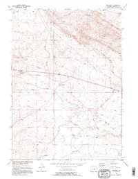
1952 Map of Waltman
USGS Topo · Published 1995About this map
Waltman serves as the focal point for this mid-century topographic study of the Wyoming interior, where the high plains transition into the drainage of the South Fork Powder River. The landscape is defined by its arid hydrology, marked by intermittent features such as Sand Draw, Waltman Draw, and the Keg Spring Draw. These seasonal watercourses, along with Waltman Spring and the Cooper Reservoir, were vital for the livestock and ranching operations that dot the area, including the Springsteen Ranch.
Find a feature on this map
15 named features on this map. Tap any name to fly to it.
Don’t see what you’re looking for? This feature index may not catch every label — zoom into the map to look around manually.
Map Details
Editions of this 1952 Waltman Map
2 editions found
Other maps of this area

1952 · Arminto
USGS Topo · 1:24,000

1952 · Waltman NW
USGS Topo · 1:24,000

1952 · Waltman
USGS Topo · 1:24,000

1952 · Hiland
USGS Topo · 1:24,000

1955 · Arminto
USGS Topo · 1:250,000

1955 · Casper
USGS Topo · 1:250,000

1958 · Casper
USGS Topo · 1:250,000

1958 · Arminto
USGS Topo · 1:250,000

1959 · Gaylord Reservoir
USGS Topo · 1:24,000

1959 · Broad Mesa
USGS Topo · 1:24,000