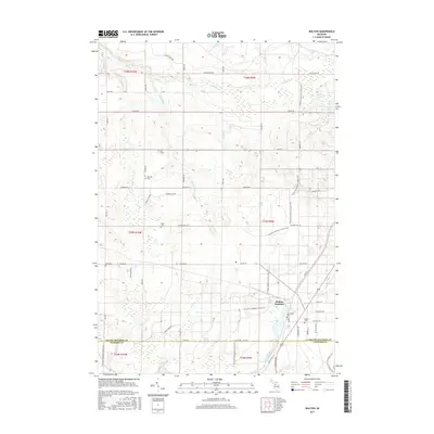
2017 Map of Walton
USGS Topo · Published 2017About this map
Walton Junction anchors this landscape at the border of Grand Traverse and Wexford counties. The area is defined by a series of wetlands and small water bodies, including Walton Marsh, Riplow Marsh, and the Walton Outlet. For those researching local family histories, the map identifies several burial sites scattered across the township, such as the Old Walton Cem, Sparling Cem, Milks Cem, and the solitary Iliff Grave.
Find a feature on this map
60 named features on this map. Tap any name to fly to it.
Don’t see what you’re looking for? This feature index may not catch every label — zoom into the map to look around manually.
Map Details
Editions of this 2017 Walton Map
This is the sole edition of this map. No revisions or reprints were ever made.
Other maps of this area

1954 · Traverse City
USGS Topo · 1:250,000

1956 · Fife Lake
USGS Topo · 1:62,500

1956 · Kingsley
USGS Topo · 1:62,500

1956 · Mesick
USGS Topo · 1:62,500

1956 · Cadillac North
USGS Topo · 1:62,500

1958 · Traverse City
USGS Topo · 1:250,000

1983 · Cadillac
USGS Topo · 1:100,000

1983 · Manton
USGS Topo · 1:25,000

1983 · Traverse City
USGS Topo · 1:100,000
1983 · Kingsley
USGS Topo · 1:25,000
Featured Places
- Paradise Township, MI
- Fife Lake Township, MI
- Union Township, MI
- Greenwood Township, MI
- Liberty Township, MI