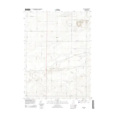
2015 Map of Walton
USGS Topo · Published 2015About this map
Walton stands as the central settlement in this portion of Lee County, where the agricultural grid is defined by a network of long-established thoroughfares such as Pump Factory Rd and Sterling Rd. The landscape is dominated by the course of the Green River, which meanders across the territory alongside drainage features like the Main Ditch. This 2015 survey provides essential data for those researching local family history, noting the exact locations of the Stevens Cem and Williams Cem. The road naming conventions here reflect a variety of influences, from the descriptive Red Brick Rd to the more modern residential feel of Sleepy Hollow Rd and Briar Knoll Rd, illustrating the gradual overlay of contemporary development onto traditional Illinois farmland.
Find a feature on this map
43 named features on this map. Tap any name to fly to it.
Don’t see what you’re looking for? This feature index may not catch every label — zoom into the map to look around manually.
Map Details
Editions of this 2015 Walton Map
This is the sole edition of this map. No revisions or reprints were ever made.
Other maps of this area

1918 · Dixon
USGS Topo · 1:62,500

1930 · Woodsung
USGS Topo · 1:48,000

1946 · Sterling
USGS Topo · 1:62,500

1948 · Sterling
USGS Topo · 1:62,500

1949 · Walnut
USGS Topo · 1:62,500

1950 · Dixon
USGS Topo · 1:62,500

1951 · Amboy
USGS Topo · 1:62,500

1958 · Aurora
USGS Topo · 1:250,000

1961 · Aurora
USGS Topo · 1:250,000

1982 · Harmon
USGS Topo · 1:24,000