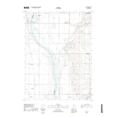
2017 Map of Wann
USGS Topo · Published 2017About this map
The Platte River and Elkhorn River converge in this western Omaha corridor, creating a landscape defined by water management and river-bottom topography. The survey shows the complex hydrologic network of the region, including the Western Sarpy Ditch, Clear Creek, and the Diversion Channel south of Venice. These water systems bisect the rural Saunders, Douglas, and Sarpy County lines, where the land transitions from the active floodplains to the growing residential fringes of Gretna.
Find a feature on this map
47 named features on this map. Tap any name to fly to it.
Don’t see what you’re looking for? This feature index may not catch every label — zoom into the map to look around manually.
Map Details
Editions of this 2017 Wann Map
This is the sole edition of this map. No revisions or reprints were ever made.
Other maps of this area

1893 · Fremont
USGS Topo · 1:125,000

1896 · Fremont
USGS Topo · 1:125,000

1955 · Fremont
USGS Topo · 1:250,000

1956 · Gretna
USGS Topo · 1:24,000

1956 · Springfield
USGS Topo · 1:24,000

1957 · Fremont
USGS Topo · 1:250,000

1958 · Fremont
USGS Topo · 1:250,000

1968 · Valley
USGS Topo · 1:24,000
1968 · Ashland East
USGS Topo · 1:24,000

1968 · Leshara
USGS Topo · 1:24,000