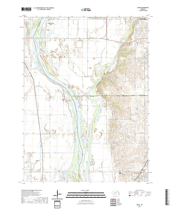
2021 Map of Wann
USGS Topo · Published 2021About this map
The confluence of the Platte River and the Elkhorn River dominates this landscape on the border of Saunders, Douglas, and Sarpy counties. The complex hydrology of the river valley is evident in the Western Sarpy Ditch, the Diversion Channel, and numerous oxbow lakes such as Trout Lake and Big Sandy Lake. A unique recreational and environmental character is highlighted by an extensive network of trails, including the The Narrows Trl, Brushbusters Trl, and Horse Camp Trl, which navigate the riparian terrain near The Narrows.
Find a feature on this map
75 named features on this map. Tap any name to fly to it.
Don’t see what you’re looking for? This feature index may not catch every label — zoom into the map to look around manually.
Map Details
Editions of this 2021 Wann Map
This is the sole edition of this map. No revisions or reprints were ever made.
Other maps of this area

1893 · Fremont
USGS Topo · 1:125,000

1896 · Fremont
USGS Topo · 1:125,000

1955 · Fremont
USGS Topo · 1:250,000

1956 · Gretna
USGS Topo · 1:24,000

1956 · Springfield
USGS Topo · 1:24,000

1957 · Fremont
USGS Topo · 1:250,000

1958 · Fremont
USGS Topo · 1:250,000

1968 · Valley
USGS Topo · 1:24,000
1968 · Ashland East
USGS Topo · 1:24,000

1968 · Leshara
USGS Topo · 1:24,000