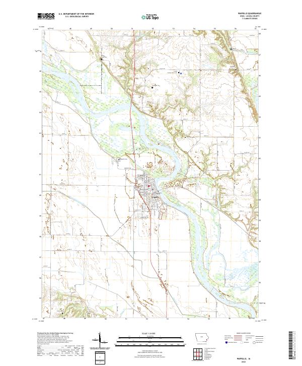
2022 Map of Wapello
USGS Topo · Published 2022About this map
Wapello serves as the focal point of this eastern Iowa landscape, situated along the winding banks of the Iowa River. As the seat of Louisa County, the town's administrative significance is marked by the Louisa County Courthouse near the intersection of State St and Main St. The surrounding geography is defined by a complex network of agricultural drainage and waterways, including the Otter Creek County Ditch and Turkey Run, which carve through the fertile bottomlands.
Find a feature on this map
54 named features on this map. Tap any name to fly to it.
Don’t see what you’re looking for? This feature index may not catch every label — zoom into the map to look around manually.
Map Details
Editions of this 2022 Wapello Map
This is the sole edition of this map. No revisions or reprints were ever made.
Other maps of this area

1946 · Wapello
USGS Topo · 1:62,500

1948 · Muscatine
USGS Topo · 1:62,500

1949 · Wapello
USGS Topo · 1:62,500

1953 · Toolesboro
USGS Topo · 1:24,000

1953 · Blanchard Island
USGS Topo · 1:24,000

1958 · Davenport
USGS Topo · 1:250,000

1961 · Davenport
USGS Topo · 1:250,000

1962 · Davenport
USGS Topo · 1:250,000
1965 · Mediapolis
USGS Topo · 1:24,000

1965 · Letts
USGS Topo · 1:24,000