
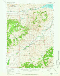
1957 Map of Wapiti
USGS Topo · Published 1959About this map
Shoshone National Forest dominates this mid-century landscape where the North Fork Shoshone River and South Fork Shoshone River converge toward the Buffalo Bill Reservoir. The map reveals a robust ranching and recreational economy along the river corridors, punctuated by family-named properties like the Siggins Brothers Ranch, Dahlem Ranch, and the Pelcher Ranch. Beyond the working ranches, the era's outdoor culture is evident through the Bi Ho Ba Girl Scout Camp and various lodges such as Broken H Lodge and River Rest Resort. High-altitude terrain features like Sheep Mountain and Table Mountain define the topography, while remote outposts like the Ishawooa Guard Sta and Hardpan Sch suggest the localized infrastructure required to support these isolated mountain communities.
Find a feature on this map
69 named features on this map. Tap any name to fly to it.
Don’t see what you’re looking for? This feature index may not catch every label — zoom into the map to look around manually.
Map Details
Editions of this 1957 Wapiti Map
2 editions found
Other maps of this area

1893 · Ishawooa
USGS Topo · 1:125,000

1895 · Ishawooa
USGS Topo · 1:125,000

1896 · Crandall Creek
USGS Topo · 1:125,000

1899 · Crandall
USGS Topo · 1:125,000

1899 · Ishawooa
USGS Topo · 1:125,000

1949 · Pat O'Hara Mountain
USGS Topo · 1:62,500

1949 · Cody
USGS Topo · 1:62,500

1951 · Cody
USGS Topo · 1:62,500

1955 · Cody
USGS Topo · 1:250,000

1956 · Dead Indian Peak
USGS Topo · 1:62,500