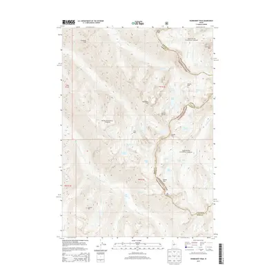
2013 Map of Warbonnet Peak
USGS Topo · Published 2013About this map
The S Fork Payette River flows through this high-elevation landscape, where the borders of Boise National Forest and Sawtooth National Forest meet. This 2013 survey of the Sawtooth Range captures a wilderness of named summits and alpine water systems. Notable landmarks such as Warbonnet Peak and Monte Verita dominate the central terrain, while the drainage network includes Baron Falls and Fern Falls. The map documents the boundary between Boise and Custer counties as it traverses the ridgelines. High-altitude lakes are abundant, from the Baron Lakes to the more isolated Dreaming Lake and Stevens Lakes. This topography is characterized by steep glacial cirques and technical peaks like Grandjean Peak and Horstmann Peak, providing a detailed view of the backcountry hydrology and land management boundaries during the early 21st century.
Find a feature on this map
47 named features on this map. Tap any name to fly to it.
Don’t see what you’re looking for? This feature index may not catch every label — zoom into the map to look around manually.
Map Details
Editions of this 2013 Warbonnet Peak Map
This is the sole edition of this map. No revisions or reprints were ever made.
Other maps of this area

1891 · Bear Valley
USGS Topo · 1:125,000

1893 · Bear Valley
USGS Topo · 1:125,000

1894 · Rocky Bar
USGS Topo · 1:125,000

1900 · Sawtooth
USGS Topo · 1:125,000

1919 · Custer
USGS Topo · 1:125,000

1922 · Custer
USGS Topo · 1:125,000

1955 · Hailey
USGS Topo · 1:250,000

1957 · Challis
USGS Topo · 1:250,000

1959 · Hailey
USGS Topo · 1:250,000

1960 · Challis
USGS Topo · 1:250,000