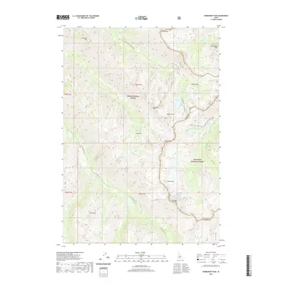
2020 Map of Warbonnet Peak
USGS Topo · Published 2020About this map
Warbonnet Peak and the surrounding high country of the Sawtooth National Forest dominate this modern survey of the Idaho wilderness. The landscape is defined by its dramatic verticality, where prominent summits like Monte Verita and Packrat Peak tower over a complex network of glacial basins and alpine waters. The map provides a precise record of the hydrological divide between the S Fork Payette River drainage and the tributaries flowing toward the Salmon River system. Significant landmarks for backcountry navigation include Baron Creek Falls, Smith Falls, and Fern Falls, which punctuate the steep descents of the mountain creeks. High-elevation basins hold clusters of water bodies such as the Upper Redfish Lakes, Baron Lakes, and Stevens Lakes, reflecting the characteristic topography of the Boise National Forest borderlands.
Find a feature on this map
43 named features on this map. Tap any name to fly to it.
Don’t see what you’re looking for? This feature index may not catch every label — zoom into the map to look around manually.
Map Details
Editions of this 2020 Warbonnet Peak Map
This is the sole edition of this map. No revisions or reprints were ever made.
Other maps of this area

1891 · Bear Valley
USGS Topo · 1:125,000

1893 · Bear Valley
USGS Topo · 1:125,000

1894 · Rocky Bar
USGS Topo · 1:125,000

1900 · Sawtooth
USGS Topo · 1:125,000

1919 · Custer
USGS Topo · 1:125,000

1922 · Custer
USGS Topo · 1:125,000

1955 · Hailey
USGS Topo · 1:250,000

1957 · Challis
USGS Topo · 1:250,000

1959 · Hailey
USGS Topo · 1:250,000

1960 · Challis
USGS Topo · 1:250,000