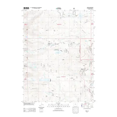
2013 Map of Ward
USGS Topo · Published 2013About this map
Ward stands as the primary mountain settlement in this high-altitude landscape within the Roosevelt National Forest. The map documents a rugged geography defined by the glacial remnants of the Arapaho Moraine and the towering heights of Mount Audubon and Niwot Mountain. Local social and institutional history is preserved through the locations of the University of Colorado Camp, Camp Harmony, and the Baptist Church Camp. The mapping of the Switzerland Trl and Gold Hill Road suggests the area's transition from early mining and rail transport to a modern focus on outdoor recreation. A complex network of high alpine water bodies, including Lake Isabelle, Left Hand Reservoir, and Silver Lake, feeds the headwaters of the South Saint Vrain Creek and Fourmile Creek. This survey captures the region just as numerous trailheads and campgrounds were becoming the primary interface with the Front Range wilderness.
Find a feature on this map
74 named features on this map. Tap any name to fly to it.
Don’t see what you’re looking for? This feature index may not catch every label — zoom into the map to look around manually.
Map Details
Editions of this 2013 Ward Map
This is the sole edition of this map. No revisions or reprints were ever made.
Other maps of this area

1899 · West Denver
USGS Topo · 1:125,000

1902 · Boulder
USGS Topo · 1:62,500

1904 · Boulder
USGS Topo · 1:62,500

1905 · Central City
USGS Topo · 1:62,500

1906 · Blackhawk
USGS Topo · 1:62,500

1910 · Central City
USGS Topo · 1:62,500

1912 · Central City
USGS Topo · 1:62,500

1915 · Longs Peak
USGS Topo · 1:125,000

1919 · Rocky Mountain National Park
USGS Topo · 1:125,000

1942 · Nederland
USGS Topo · 1:24,000