
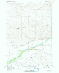
1951 Map of Wardel Reservoir
USGS Topo · Published 1953About this map
Wardel Reservoir and Sandstone Reservoir dominate the northern landscape of this 1951 Wyoming survey, serving as vital water storage for the surrounding Big Horn Basin. This map records an extensive network of human-made irrigation infrastructure, including the Joe Canal, Fairview Ditch, Grout Ditch, and Extension Ditch. These features illustrate the mid-century efforts to manage water in an arid environment, part of a larger federal initiative for the development of the Missouri River Basin.
Find a feature on this map
13 named features on this map. Tap any name to fly to it.
Don’t see what you’re looking for? This feature index may not catch every label — zoom into the map to look around manually.
Map Details
Editions of this 1951 Wardel Reservoir Map
This is the sole edition of this map. No revisions or reprints were ever made.
Other maps of this area

1951 · Burlington
USGS Topo · 1:24,000

1951 · Sucker Dam
USGS Topo · 1:24,000

1951 · Schuster Flats NW
USGS Topo · 1:24,000

1951 · Sheep Mountain
USGS Topo · 1:24,000

1951 · Otto
USGS Topo · 1:24,000

1951 · Dutch Nick Flat NW
USGS Topo · 1:24,000

1955 · Cody
USGS Topo · 1:250,000

1958 · Cody
USGS Topo · 1:250,000

1962 · Cody
USGS Topo · 1:250,000
1966 · Gould Butte
USGS Topo · 1:24,000