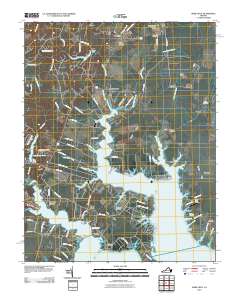
2010 Map of Ware Neck
USGS Topo · Published 2010About this map
North River and the Ware River dominate this coastal Virginia landscape, where the intricate network of tidal creeks and named points defines the layout of several centuries-old landings. The geography of the Middle Peninsula is well-preserved here, showing the continued importance of the waterfront at sites like Hockley Wharf and Auburn Wharf Landing. Local history and genealogy are anchored by several established burial grounds, including Locust Grove Cemetery near Soles and Emmaus Cemetery further south. The map documents a blend of traditional maritime character and modern development, from the historic site of Fort Nonsense to the more recent Glen Roy Estates. Small aviation hubs like Hudgins Farm Ultralight Airport and Handy Strip appear alongside traditional waterman's landmarks such as Baileys Wharf Beacon and Lone Point Light, reflecting the area's ongoing connection to both the water and the sky.
Find a feature on this map
112 named features on this map. Tap any name to fly to it.
Don’t see what you’re looking for? This feature index may not catch every label — zoom into the map to look around manually.
Map Details
Editions of this 2010 Ware Neck Map
This is the sole edition of this map. No revisions or reprints were ever made.
Other maps of this area

1906 · Williamsburg
USGS Topo · 1:62,500

1916 · Kilmarnock
USGS Topo · 1:48,000

1916 · Mathews
USGS Topo · 1:62,500

1917 · Urbanna
USGS Topo · 1:62,500

1917 · Kilmarnock
USGS Topo · 1:62,500

1917 · Mathews
USGS Topo · 1:62,500

1942 · Kilmarnock
USGS Topo · 1:62,500

1943 · Richmond
USGS Topo · 1:250,000

1948 · Ware Neck
USGS Topo · 1:24,000

1948 · Achilles
USGS Topo · 1:24,000