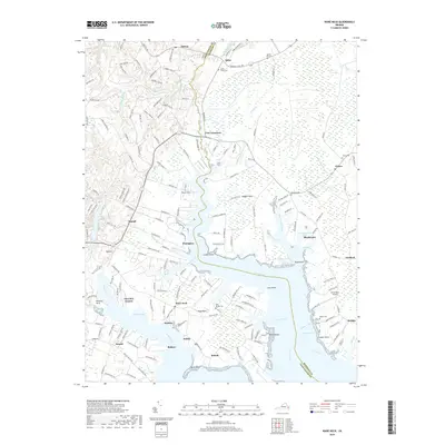
2019 Map of Ware Neck
USGS Topo · Published 2019About this map
North River and Ware River carve deep into the Virginia Tidewater, defining a landscape of low-lying peninsulas and sheltered coves in this 2019 survey. The map details the intricate shoreline where Cradle Point, Horse Point, and Cedar Point reach into the tidal waters. Inland, small rural settlements and crossroads such as Fort Nonsense, Zanoni, and Elmington are connected by a network of local roads like Wagon Run Rd and Dutton Rd. This area is characterized by its agricultural and residential character, with numerous family and community cemeteries such as Locust Grove Cem and Emmaus Cem scattered throughout the woodland and field boundaries. The presence of Holly Point Airport near the eastern shore highlights the modern utility of these coastal peninsulas, while the complex naming of small inlets like Salisbury Creek and Smith Lot Creek reflects generations of local navigation and land use in Gloucester and Mathews Counties.
Find a feature on this map
65 named features on this map. Tap any name to fly to it.
Don’t see what you’re looking for? This feature index may not catch every label — zoom into the map to look around manually.
Map Details
Editions of this 2019 Ware Neck Map
This is the sole edition of this map. No revisions or reprints were ever made.
Other maps of this area

1906 · Williamsburg
USGS Topo · 1:62,500

1916 · Kilmarnock
USGS Topo · 1:48,000

1916 · Mathews
USGS Topo · 1:62,500

1917 · Urbanna
USGS Topo · 1:62,500

1917 · Kilmarnock
USGS Topo · 1:62,500

1917 · Mathews
USGS Topo · 1:62,500

1942 · Kilmarnock
USGS Topo · 1:62,500

1943 · Richmond
USGS Topo · 1:250,000

1948 · Ware Neck
USGS Topo · 1:24,000

1948 · Achilles
USGS Topo · 1:24,000