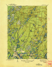
1939 Map of Wareham
USGS Topo · Published 1939About this map
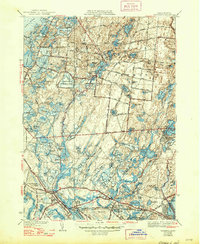
The Agawam River and its associated wetlands define this landscape during the mid-1930s, showing an area deeply intertwined with the cranberry industry and early state conservation efforts. The northern reaches are dominated by Myles Standish State Forest, a vast wooded tract dotted with numerous glacial kettle ponds such as College Pond and Three Cornered Pond. This area also includes a CCC Camp, reflecting New Deal-era infrastructure projects. In the south, the industrial and residential core centers on Wareham, where the New York New Haven and Hartford RR provides a critical transportation corridor near the Agawam River. The map meticulously records the extensive network of cranberry operations, including the Federal Bogs, Wankinco Cranberry Bog, and State Bog. Smaller residential pockets like Oakdale and Riverside sit near the river's edge, while landmarks such as Brandy Hill and the Wareham Pumping Sta provide specific points of reference for local historians.
Find a feature on this map
97 named features on this map. Tap any name to fly to it.
Don’t see what you’re looking for? This feature index may not catch every label — zoom into the map to look around manually.
Map Details
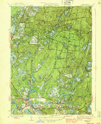
Editions of this 1939 Wareham Map
5 editions found
Other maps of this area

1885 · New Bedford
USGS Topo · 1:62,500

1885 · Middleboro
USGS Topo · 1:62,500

1886 · Falmouth
USGS Topo · 1:62,500

1886 · Plymouth
USGS Topo · 1:62,500

1888 · New Bedford
USGS Topo · 1:62,500

1888 · Falmouth
USGS Topo · 1:62,500

1888 · Middleboro
USGS Topo · 1:62,500

1889 · Plymouth
USGS Topo · 1:62,500

1893 · Middleboro
USGS Topo · 1:62,500

1893 · Falmouth
USGS Topo · 1:62,500