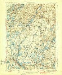
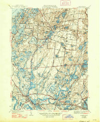
1939 Map of Wareham
USGS Topo · Published 1939About this map
Cranberry cultivation dominates the lowlands of Plymouth County in the late 1930s, where an intricate network of specialized agriculture defines the landscape. The proliferation of named bogs, such as Wankinco Cranberry Bog and Frogfoot Cranberry Bogs, reflects a highly developed industry dependent on the region's unique hydrology. This water-rich environment is further characterized by numerous glacial kettle ponds, including College Pond, Fearing Pond, and the expansive White Island Pond, many of which are contained within the boundaries of Myles Standish State Forest.
Find a feature on this map
117 named features on this map. Tap any name to fly to it.
Don’t see what you’re looking for? This feature index may not catch every label — zoom into the map to look around manually.
Map Details
Editions of this 1939 Wareham Map
5 editions found
Other maps of this area

1885 · New Bedford
USGS Topo · 1:62,500

1885 · Middleboro
USGS Topo · 1:62,500

1886 · Falmouth
USGS Topo · 1:62,500

1886 · Plymouth
USGS Topo · 1:62,500

1888 · New Bedford
USGS Topo · 1:62,500

1888 · Falmouth
USGS Topo · 1:62,500

1888 · Middleboro
USGS Topo · 1:62,500

1889 · Plymouth
USGS Topo · 1:62,500

1893 · Middleboro
USGS Topo · 1:62,500

1893 · Falmouth
USGS Topo · 1:62,500