Loading...
Loading map...2022 Map of Warfield
USGS Topo · Published 2022About this map
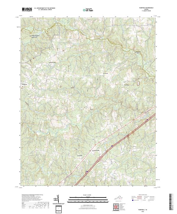
Warfield and the neighboring settlements of Sturgeonville and Kress define the rural character of this Brunswick County landscape. The area is heavily intersected by small watercourses and creeks, including Sturgeon Cr, Jack Rock Br, and Big Br, which feed into the larger river systems. In the north, the Nottoway River forms a portion of the boundary between Dinwiddie Co and Brunswick Co, near the small hamlet of Baskerville Mill.
Find a feature on this map
61 named features on this map. Tap any name to fly to it.
Don’t see what you’re looking for? This feature index may not catch every label — zoom into the map to look around manually.
Map Details
Date Portrayed2022
Date Published2022
PublisherU.S. Geological Survey
Map TypeTopographic
Scale1:24,000
Physical Dimensions24 x 29 inches
Editions of this 2022 Warfield Map
This is the sole edition of this map. No revisions or reprints were ever made.
Historical Maps of Rawlings Through Time
Featured Locations
Source Details
SourceU.S. Geological Survey
CopyrightPublic Domain