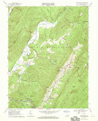
1968 Map of Warm Springs
USGS Topo · Published 1970About this map
Warm Springs Mountain and Cobbler Mountain dominate this corner of the George Washington National Forest, defining a landscape of deep valleys and narrow runs during the late 1960s. The Jackson River winds through the western portion of the map, flanked by settlements such as Bacova and Bacova Junction, which were linked to the wider region by the Chesapeake and Ohio railroad. This survey captures a moment of established community life in Bath County, evidenced by several country churches like Mt Pisgah Ch and John Wesley Ch near the cluster of Shakerag.
Find a feature on this map
59 named features on this map. Tap any name to fly to it.
Don’t see what you’re looking for? This feature index may not catch every label — zoom into the map to look around manually.
Map Details
Editions of this 1968 Warm Springs Map
2 editions found
Other maps of this area

1894 · Natural Bridge
USGS Topo · 1:125,000

1901 · Monterey
USGS Topo · 1:125,000

1923 · Warm Springs
USGS Topo · 1:48,000

1926 · Warm Springs
USGS Topo · 1:62,500

1929 · Falling Spring
USGS Topo · 1:24,000

1930 · Warm Springs Run
USGS Topo · 1:24,000

1930 · Mountain Grove
USGS Topo · 1:24,000

1931 · Healing Springs
USGS Topo · 1:24,000

1932 · Falling Spring
USGS Topo · 1:31,680

1933 · Mountain Grove
USGS Topo · 1:31,680