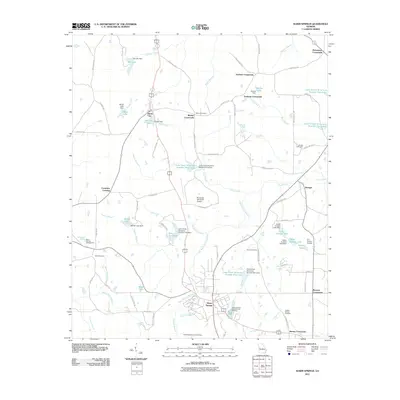
2011 Map of Warm Springs
USGS Topo · Published 2011About this map
Warm Springs and its surrounding crossroads serve as the focal point for this Meriwether County landscape, characterized by an extensive network of small reservoirs and named family landmarks. The area's legacy of thermal waters and conservation is evident in the Warm Springs National Fish Hatchery and Meriwether Spring, while aviation history is marked by the Roosevelt Memorial Airport and the E H Hutton Airstrip.
Find a feature on this map
91 named features on this map. Tap any name to fly to it.
Don’t see what you’re looking for? This feature index may not catch every label — zoom into the map to look around manually.
Map Details
Editions of this 2011 Warm Springs Map
This is the sole edition of this map. No revisions or reprints were ever made.
Other maps of this area

1907 · Talbotton
USGS Topo · 1:125,000

1934 · Warm Springs
USGS Topo · 1:62,500

1936 · Warm Springs
USGS Topo · 1:62,500

1953 · Atlanta
USGS Topo · 1:250,000

1955 · Phenix City
USGS Topo · 1:250,000

1957 · Phenix City
USGS Topo · 1:250,000

1957 · Atlanta
USGS Topo · 1:250,000

1958 · Phenix City
USGS Topo · 1:250,000

1958 · Atlanta
USGS Topo · 1:250,000
1964 · Pine Mountain
USGS Topo · 1:24,000