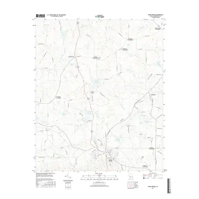
2017 Map of Warm Springs
USGS Topo · Published 2017About this map
Warm Springs and the surrounding Meriwether County countryside appear in this survey, showcasing a landscape defined by small rural hubs and water management. Numerous namesake crossroads, including Barnes Crossroads and Snelsons Crossroads, anchor the local road network, while the city of Harris City lies to the north. The area is notable for its concentration of family and community burial grounds such as Barnes Cem, Brooks Cem, and the Judson Bulloch Cem located near Bussey Crossroads.
Find a feature on this map
113 named features on this map. Tap any name to fly to it.
Don’t see what you’re looking for? This feature index may not catch every label — zoom into the map to look around manually.
Map Details
Editions of this 2017 Warm Springs Map
This is the sole edition of this map. No revisions or reprints were ever made.
Other maps of this area

1907 · Talbotton
USGS Topo · 1:125,000

1934 · Warm Springs
USGS Topo · 1:62,500

1936 · Warm Springs
USGS Topo · 1:62,500

1953 · Atlanta
USGS Topo · 1:250,000

1955 · Phenix City
USGS Topo · 1:250,000

1957 · Phenix City
USGS Topo · 1:250,000

1957 · Atlanta
USGS Topo · 1:250,000

1958 · Phenix City
USGS Topo · 1:250,000

1958 · Atlanta
USGS Topo · 1:250,000
1964 · Pine Mountain
USGS Topo · 1:24,000