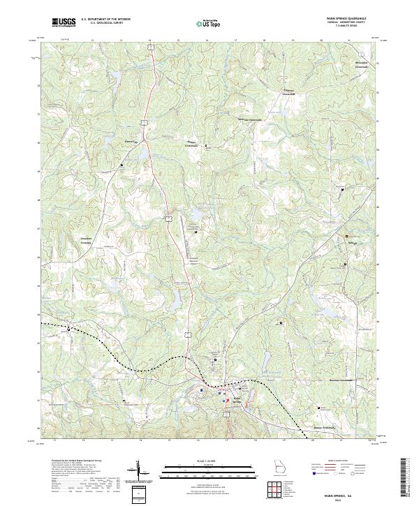
2024 Map of Warm Springs
USGS Topo · Published 2024About this map
Warm Springs serves as the focal point of this Meriwether County landscape, positioned near the foot of Marys Mountain. The area is defined by a traditional network of agricultural crossroads and rural settlements, including Harris City, Raleigh, and Barnes Crossroads. A notable concentration of community landmarks appears throughout the terrain, from the Warm Springs National Fish Hatchery to the Roosevelt Memorial Airport. The map documents numerous historic burial grounds and congregational sites such as Leverette Hill Church Cem and Mount Hope Church Cem, which are essential for tracing local family lineages. Water resources are prominent, with several flood control structures like Cane Cr Structure Number Four Lake and Cane Cr Structure Number Three Lake highlighting the local watershed management. The presence of the Warm Springs City Cem and the distinctive Meriwether Spring underscores the long-standing significance of the local geology and community development.
Find a feature on this map
117 named features on this map. Tap any name to fly to it.
Don’t see what you’re looking for? This feature index may not catch every label — zoom into the map to look around manually.
Map Details
Editions of this 2024 Warm Springs Map
This is the sole edition of this map. No revisions or reprints were ever made.
Other maps of this area

1907 · Talbotton
USGS Topo · 1:125,000

1934 · Warm Springs
USGS Topo · 1:62,500

1936 · Warm Springs
USGS Topo · 1:62,500

1953 · Atlanta
USGS Topo · 1:250,000

1955 · Phenix City
USGS Topo · 1:250,000

1957 · Phenix City
USGS Topo · 1:250,000

1957 · Atlanta
USGS Topo · 1:250,000

1958 · Phenix City
USGS Topo · 1:250,000

1958 · Atlanta
USGS Topo · 1:250,000
1964 · Pine Mountain
USGS Topo · 1:24,000