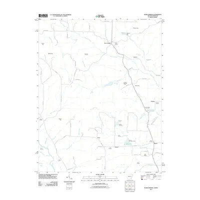
2011 Map of Warm Springs
USGS Topo · Published 2011About this map
Warm Springs and the surrounding rural communities of Palestine, Hamil, and Antioch define the landscape of northern Randolph County at the turn of the 21st century. This region is characterized by a high concentration of small, family-named burial grounds and local landmarks, including Whittenberg Cemetery, Spikes Cemetery, and Looney Cemetery, which provide essential touchpoints for genealogical research. The terrain is a network of ridges and water sources, such as Phillips Knob and Green Fork Creek, interspersed with natural springs like Cowden Spring and Wooldridge Spring. Significant water management is evident through a series of dams and reservoirs along the tributaries, such as the Fourche Creek Site 17 Reservoir and Wallace Lake. The presence of numerous old roads and trails, including Sleepy Hollow Trl and Pawnee Trl, indicates a persistent rural settlement pattern that follows the natural contours and creek beds of the area.
Find a feature on this map
83 named features on this map. Tap any name to fly to it.
Don’t see what you’re looking for? This feature index may not catch every label — zoom into the map to look around manually.
Map Details
Editions of this 2011 Warm Springs Map
This is the sole edition of this map. No revisions or reprints were ever made.
Other maps of this area

1935 · Reyno
USGS Topo · 1:62,500

1939 · Doniphan
USGS Topo · 1:62,500

1941 · Gatewood
USGS Topo · 1:62,500

1945 · Doniphan
USGS Topo · 1:62,500

1945 · Gatewood
USGS Topo · 1:62,500

1957 · Poplar Bluff
USGS Topo · 1:250,000

1959 · Poplar Bluff
USGS Topo · 1:250,000

1960 · Poplar Bluff
USGS Topo · 1:250,000

1965 · Gatewood
USGS Topo · 1:24,000

1966 · Ravenden Springs
USGS Topo · 1:24,000