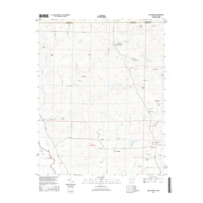
2014 Map of Warm Springs
USGS Topo · Published 2014About this map
Warm Springs anchors the northern reaches of Randolph County, situated just below the state line where Ripley County, Missouri, meets Arkansas. This rural landscape is defined by its deep network of family burial grounds and small settlements that speak to generations of residency in the Ozark foothills. Genealogical interest is particularly high here, with Warm Springs Cemetery, Macedonia Cemetery, and Whittenberg Cemetery marking the hillsides. The terrain transitions from the Bellah Hills and Stone Hill in the west toward the eastern drainage of Mud Creek and Shaver Creek. The southwestern corner of the quadrangle is marked by the Eleven Point River, while the center contains engineered water features such as the Fourche Creek Site 17 Reservoir and Fourche Creek Site 18 Reservoir, illustrating modern land management alongside the older crossroads of Antioch and Hamil.
Find a feature on this map
88 named features on this map. Tap any name to fly to it.
Don’t see what you’re looking for? This feature index may not catch every label — zoom into the map to look around manually.
Map Details
Editions of this 2014 Warm Springs Map
This is the sole edition of this map. No revisions or reprints were ever made.
Other maps of this area

1935 · Reyno
USGS Topo · 1:62,500

1939 · Doniphan
USGS Topo · 1:62,500

1941 · Gatewood
USGS Topo · 1:62,500

1945 · Doniphan
USGS Topo · 1:62,500

1945 · Gatewood
USGS Topo · 1:62,500

1957 · Poplar Bluff
USGS Topo · 1:250,000

1959 · Poplar Bluff
USGS Topo · 1:250,000

1960 · Poplar Bluff
USGS Topo · 1:250,000

1965 · Gatewood
USGS Topo · 1:24,000

1966 · Ravenden Springs
USGS Topo · 1:24,000