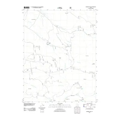
2011 Map of Warner Lake
USGS Topo · Published 2011About this map
Castleton and the high elevations of the La Sal range dominate this landscape as it appeared in the early 21st century. The map tracks a complex drainage system where Castle Creek and its many tributaries, including Spring Creek and Placer Creek, carve through the red rock terrain below Adobe Mesa. This survey is particularly useful for identifying modern access to remote landmarks like the Jerry Stocks Mine and the high-altitude recreation areas surrounding Warner Lake and Lake Oowah. Cultural features such as the Porcupine Ranch and the historical site of Miners Basin provide focal points for local history research. The topography is defined by significant overlooks and mesas, including Wilson Mesa and South Mesa, connected by a network of forest roads such as Mountain Loop Rd and Castleton Rd.
Find a feature on this map
42 named features on this map. Tap any name to fly to it.
Don’t see what you’re looking for? This feature index may not catch every label — zoom into the map to look around manually.
Map Details
Editions of this 2011 Warner Lake Map
This is the sole edition of this map. No revisions or reprints were ever made.
Other maps of this area

1885 · La Sal
USGS Topo · 1:250,000

1954 · Mt. Waas 4 SW
USGS Topo · 1:24,000

1954 · Mt. Waas 4 NW
USGS Topo · 1:24,000

1954 · Mt Peale 1 NW
USGS Topo · 1:24,000

1954 · Mt Peale 2 NW
USGS Topo · 1:24,000

1954 · Mt. Waas 3 NE
USGS Topo · 1:24,000

1954 · Mt. Waas 3 SE
USGS Topo · 1:24,000

1954 · Mt Peale 2 NE
USGS Topo · 1:24,000

1954 · Mt. Waas 3 NW
USGS Topo · 1:24,000

1954 · Mt. Waas 3 SW
USGS Topo · 1:24,000