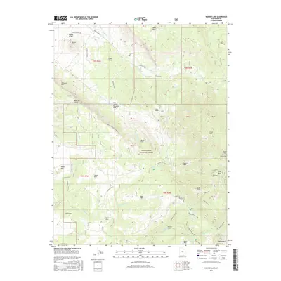
2017 Map of Warner Lake
USGS Topo · Published 2017About this map
Castle Valley occupies the northwest portion of this landscape, characterized by dramatic landforms such as Round Mtn and the steep Porcupine Rim. To the southeast, the terrain rises into the Manti-LaSal National Forest, where high-elevation landmarks like Gold Knob and Horse Mtn overlook the drainage of Mill Cr. The presence of the Castleton Cem and the Miners Basin district suggests a history of early mountain settlement and extraction in these high alpine basins.
Find a feature on this map
56 named features on this map. Tap any name to fly to it.
Don’t see what you’re looking for? This feature index may not catch every label — zoom into the map to look around manually.
Map Details
Editions of this 2017 Warner Lake Map
This is the sole edition of this map. No revisions or reprints were ever made.
Other maps of this area

1885 · La Sal
USGS Topo · 1:250,000

1954 · Mt. Waas 4 SW
USGS Topo · 1:24,000

1954 · Mt. Waas 4 NW
USGS Topo · 1:24,000

1954 · Mt Peale 1 NW
USGS Topo · 1:24,000

1954 · Mt Peale 2 NW
USGS Topo · 1:24,000

1954 · Mt. Waas 3 NE
USGS Topo · 1:24,000

1954 · Mt. Waas 3 SE
USGS Topo · 1:24,000

1954 · Mt Peale 2 NE
USGS Topo · 1:24,000

1954 · Mt. Waas 3 NW
USGS Topo · 1:24,000

1954 · Mt. Waas 3 SW
USGS Topo · 1:24,000