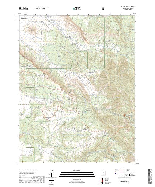
2023 Map of Warner Lake
USGS Topo · Published 2023About this map
Castle Valley and the high peaks of the La Sal Mountains define this high-altitude landscape in Grand County. The topography transitions from the dramatic vertical walls of Adobe Mesa and Fisher Mesa in the north to the heavily timbered slopes of the Manti-La-Sal National Forest in the south. This modern survey captures the intricate network of backcountry access points, including the Kokopelli Trl and Sand Flats Rd, which cross the high plateaus of Wilson Mesa and South Mesa. Genealogical and historical interest is found at the Castleton Cemetery near Castle Creek, and the former mining site at Miners Basin. Higher elevations include secluded water bodies like Warner Lake and Oowah Lake, surrounded by landmarks such as Gold Knob and Boren Mesa.
Find a feature on this map
55 named features on this map. Tap any name to fly to it.
Don’t see what you’re looking for? This feature index may not catch every label — zoom into the map to look around manually.
Map Details
Editions of this 2023 Warner Lake Map
This is the sole edition of this map. No revisions or reprints were ever made.
Other maps of this area

1885 · La Sal
USGS Topo · 1:250,000

1954 · Mt. Waas 4 SW
USGS Topo · 1:24,000

1954 · Mt. Waas 4 NW
USGS Topo · 1:24,000

1954 · Mt Peale 1 NW
USGS Topo · 1:24,000

1954 · Mt Peale 2 NW
USGS Topo · 1:24,000

1954 · Mt. Waas 3 NE
USGS Topo · 1:24,000

1954 · Mt. Waas 3 SE
USGS Topo · 1:24,000

1954 · Mt Peale 2 NE
USGS Topo · 1:24,000

1954 · Mt. Waas 3 NW
USGS Topo · 1:24,000

1954 · Mt. Waas 3 SW
USGS Topo · 1:24,000